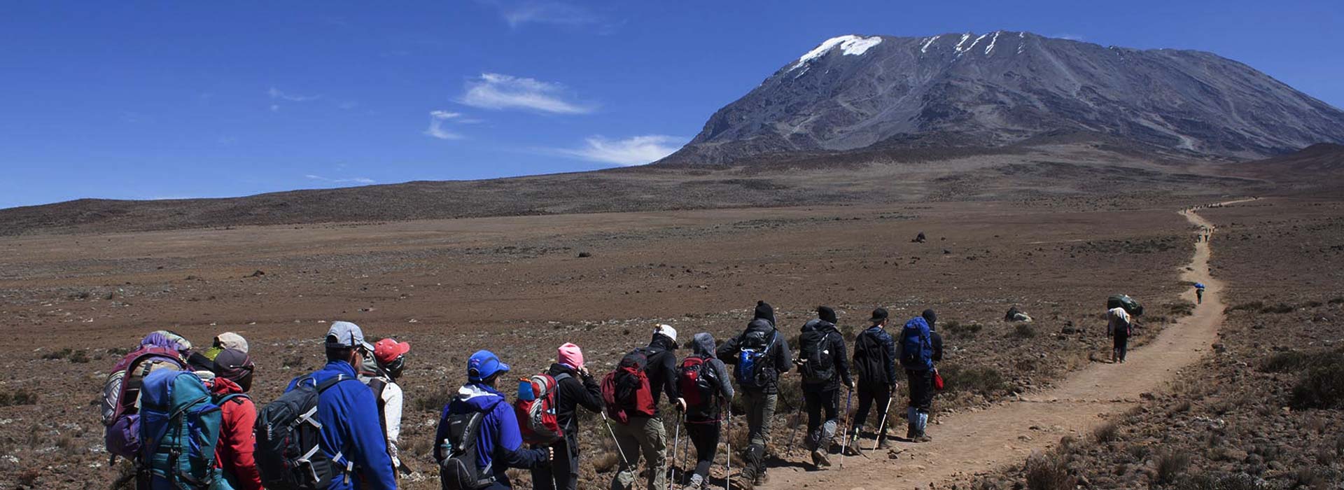
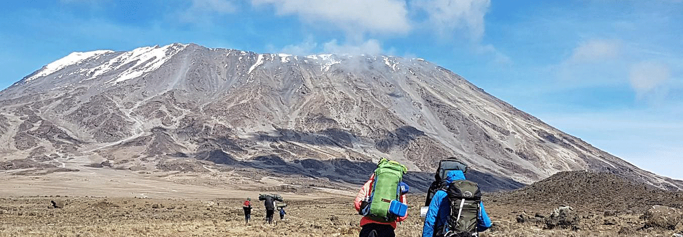
7-Day Kilimanjaro Lemosho Route Itinerary
Tour Overview
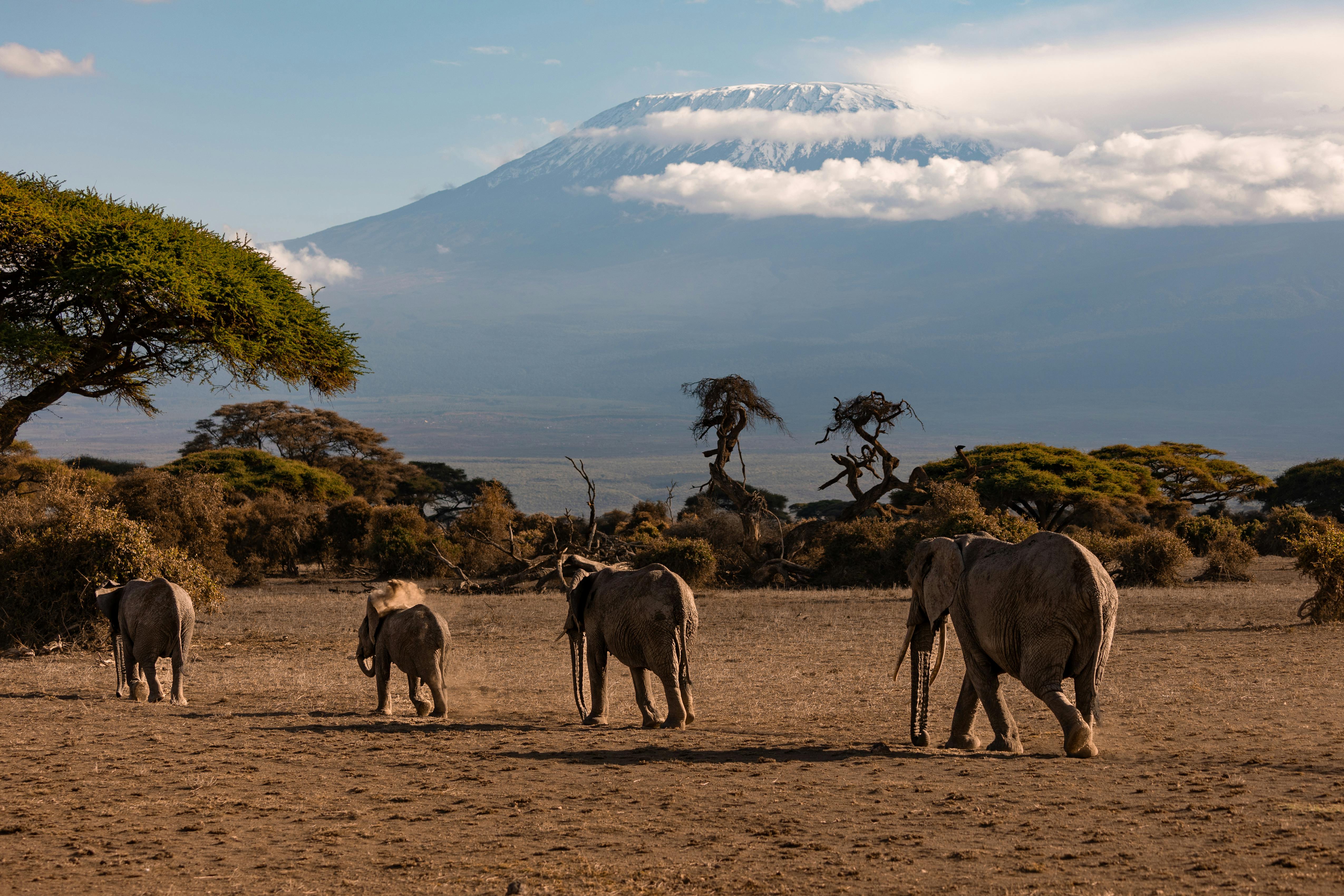
Considered the most beautiful and lush of all the Kilimanjaro routes, it is also the most remote. The Lemosho Gate is located on the western mountainside and serves as an alternative to the Shira route. After seeing the beautiful forests and moorlands, this route crosses the Shira Plateau on day 4 where it connects with the Machame route at Lava Tower. It then shifts downward toward Barranco Valley through the Southern Circuit. You might be fortunate enough to spot some wildlife such as elephants and buffalos. Although we recommend a minimum of 7 days to attempt this route, for better acclimatization and summit success, 8 days is preferable. Day 0 - ARRIVALS After meeting me at Kilimanjaro Airport JRO, we will drive for an hour to a hotel in Moshi Town, where we will prepare for the trek. You will spend the rest of the day either at the hotel or exploring Moshi town. On this day, I will brief you on all the details of your trek and examine your trekking equipment. Should you find yourself short of essential gear, I will guide you on how to acquire them from local rental shops.
Highlights
- Highest Peak in Africa
- One of the Seven Summits
- Location Tanzania
- Non-Technical Climb
- Stunning Sunrise at the Summit
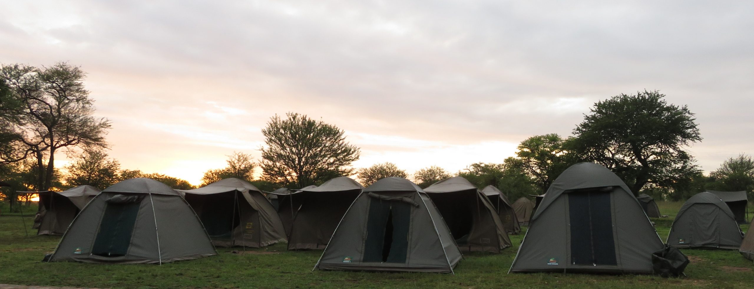
- Camping - Accommodation
- Unique Landscapes and Wildlife
- A Bucket-List Achievement
Day to Day Trip
Day 1: Moshi to Lemosho gate To (Mti Mkubwa) BigTree Camp :
At approximately 08:00 am, you will be picked up from your hotel and taken to Lemosho gate, situated on the western part of Kilimanjaro, a journey taking roughly three hours. After registering, you will begin your climb towards Big Tree camp, where you will be spending the night. This involves a steady climb through the forests of the Lemosho glades, and you will start your climb seamlessly. Elevation: Lemosho gate 2100m to Mti Mkubwa camp 2700m Driving Distance: 94km/58 miles (3 hours) Walking Distance From Gate To Big Tree Camp: 7km / 4.3mi Walking Time: 3 to 4 Hrs Habitat : Montane Forest Meals: Breakfast, Lunch & Dinner
Day 2: Mti Mkubwa Camp to Shira 2 Camp
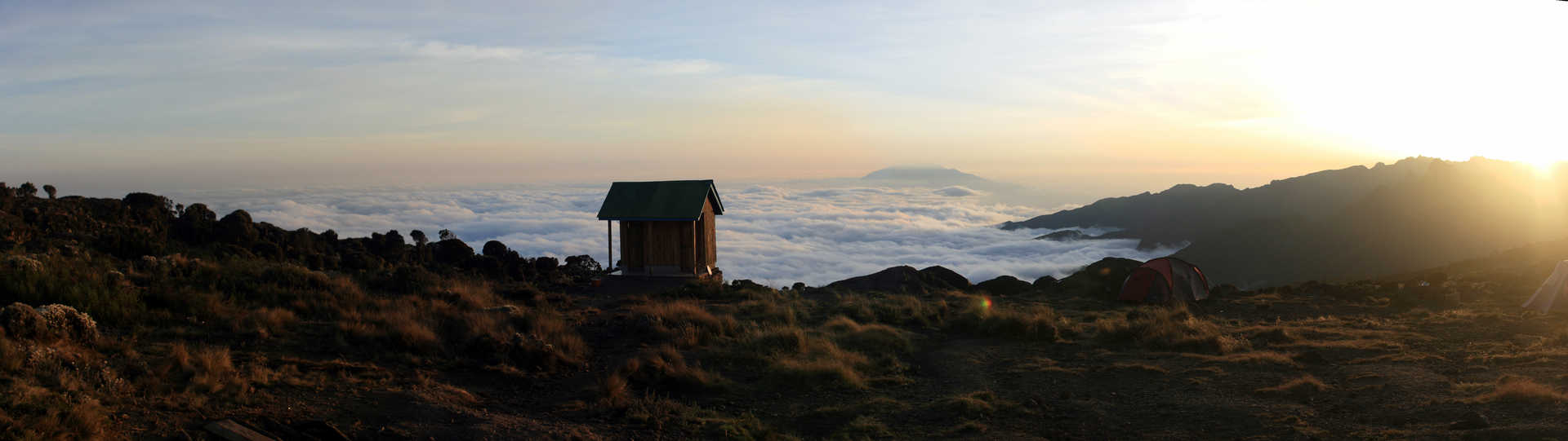
After eating breakfast, you will begin to ascend from the rainforest to the heather moorland zone. You will traverse numerous streams and walk on a plateau towards Shira 2 Camp, which is situated at an altitude of 3840m. At this campsite you will be situated next to a stream which has a western view of Western Breach and Eastern view of the Glaciers in the East. Just like the first night, your tents will be ready prior to mid-point visit and the porters will be waiting to serve drinking water and washing water. After this, you will munch on evening snacks, after which dinner will be served from our chef. Remember this campsite is cold and exposed, temperatures will be far below 0°. Elevation: Mti Mkubwa Camp 2,700m to Shira 2 camp 3,850m Distance: 16km / 10mi Estimated Time: 6 to 8 Hrs Habitat: Moorland / Heather Meals: Breakfast, Lunch and Dinner.
Day 3: Shira Camp 2 to Barranco Camp
Your journey commences with an upward movement with sweeping views, trekking into the climatic zone of the upland desert and on the lava ridges beneath the glaciers of the Western Breach. The distinct pinnacle of the Lava Tower (4600 m) will be reached, which will be the highlight of the hike for the day and a delightful spot to savor lunch. In the afternoon, we will descend steeply to our campsite for the night at the base of the Great Barranco Valley (3960 m), which is surrounded by towering cliffs but offers extensive views of the plains below. This is the best day for great acclimatization vertification. Elevation: Shira Camp 2 3850 m to Lava Tower 4600m to Barranco Camp 3960m Walking distance: 10 km/6 miles Walking time: 5-6 hours Habitat: Semi-Desert Meals: Breakfast, Lunch & Dinner.
Day 4: Baranco camp To Karanga Camp:
Today we will begin with the striking Barranco Wall. Very soon you will see that it looks worse than it is. However, there are sections where you will need to hold on tight and help yourself. From the top, be sure to admire the views. The remainder of the route goes along the mountain ridge into the Karanga valley and out. You will reach Karanga Camp after lunch and you will be able to have fantastic views of the southern glacier of Kibo as well as the Kibo summit. Elevation: Barranco Camp 3960m to KarangaCamp 4000m Walking Distance: 5 km /3.1mi Walking Time: 3-4 Hours Habitat: Moorland & Semi Desert Meals: Breakfast, Lunch & Dinner.
Day 5: Karanga Camp To Barafu Camp
You will depart from Karanga Camp (4000m) after breakfast. The trail merges with Mweka Route which is the route used for descending on the last two days. After one hour of hiking, you will reach Barafu Hut which is the last water point for the porters since there is no water accessible at Barafu Camp (4550m). Barafu means ice in Swahili and this camp is situated on a stark exposed ridge. Tents will be subject to wind and rock fall so it is crucial for hikers to orient themselves with the campsite before dusk. Elevation: Karanga Camp 4000m to Barafu Camp 4600m Walking Distance: 4 km /2.5mi Walking Time: 3-4 Hours Habitat: Semi Desert Meals: Breakfast, Lunch & Dinner
Day 6: Barafu Camp To Uhuru Peak, Down To Mweka Camp
Your day starts bright and early – rightafter midnight! As part of your climbing team, I will wake you up with a refreshing hot cup of tea along with some light snacks for energy as you get dressed to prepare your daypack for the encounter ahead. Since you will be hiking in complete darkness for the next 5-7 hours, take your time and reach Stella Point a few hours before dawn. From here, there is another two hours of intense hiking before you reach the ultimate goal, Uhuru Peak. At 5,985m, you will be able to experience a breathtaking sunrise along with the panoramic view. Congratulations, you did it! Soaking it all in after snapping your photos, you will start the descent back down to Barafu Camp, where you will stop for lunch and some celebration. A bit of rest will help you continue down to Mweka Camp to overnight. Elevation: 4600m to 5895m/19,340ft Down to 3090m Distance: 5km/3mi up / 13km/8mi down Hiking Time: 5-7 hours up / 5-6 hours down Habitat: Ice-capped, Stone scree, Heather and moorland Meals: Breakfast, Lunch & Dinner.
Day 7: Mweka Camp to Mweka Gate to Moshi
Your descent back to civilization starts on the full stomach and the Uhuru Peak hike that you undertook is now a glorious memory. The trail can be slippery so exercises caution with your knees! You might get a chance to spot a colobus monkey and enjoy the views of the misty cloud forest. Along with the summit certificates you will be receiving at the Mweka Gate, do not forget to tip your guide, cook, and porters. Now it's time for a well-deserved celebration! Elevation: From 3090m to 1680m Distance: 10km / 6 miles Hiking Time: 3 to 4 hours Habitat: Montane Forest Meals: Breakfast, Lunch.
INCLUDED
- Park fees, camping fees & rescue fees
- 18% VAT on tour fees & services
- 4 Season mountain tents with sleeping mats
- Transportation to & from the mountain gate
- Professional mountain guides, cooks and porters
- 3 meals daily while on the mountain
- Purified and filtered water throughout the trek
- Pre & Post Trek accommodation in Moshi town
- Fair wages for the mountain crew as approved by the
- 2-way airport transfers – 1 on arrival and 1 on departure
- Supplemental Oxygen & Pulse Oximeter
- Hot Water For Wash on all days in mountain
- The first to edit and put Parkfees
- camping fees and rescue fees
EXCLUDED
- Flights, Visa and Travel Insurance
- Gratitude/Tips to crew members (highly recommended)
- Personal Climbing Gears
- Laundry Services
- Items of a personal nature
Book Now
PLACE TO VISIT

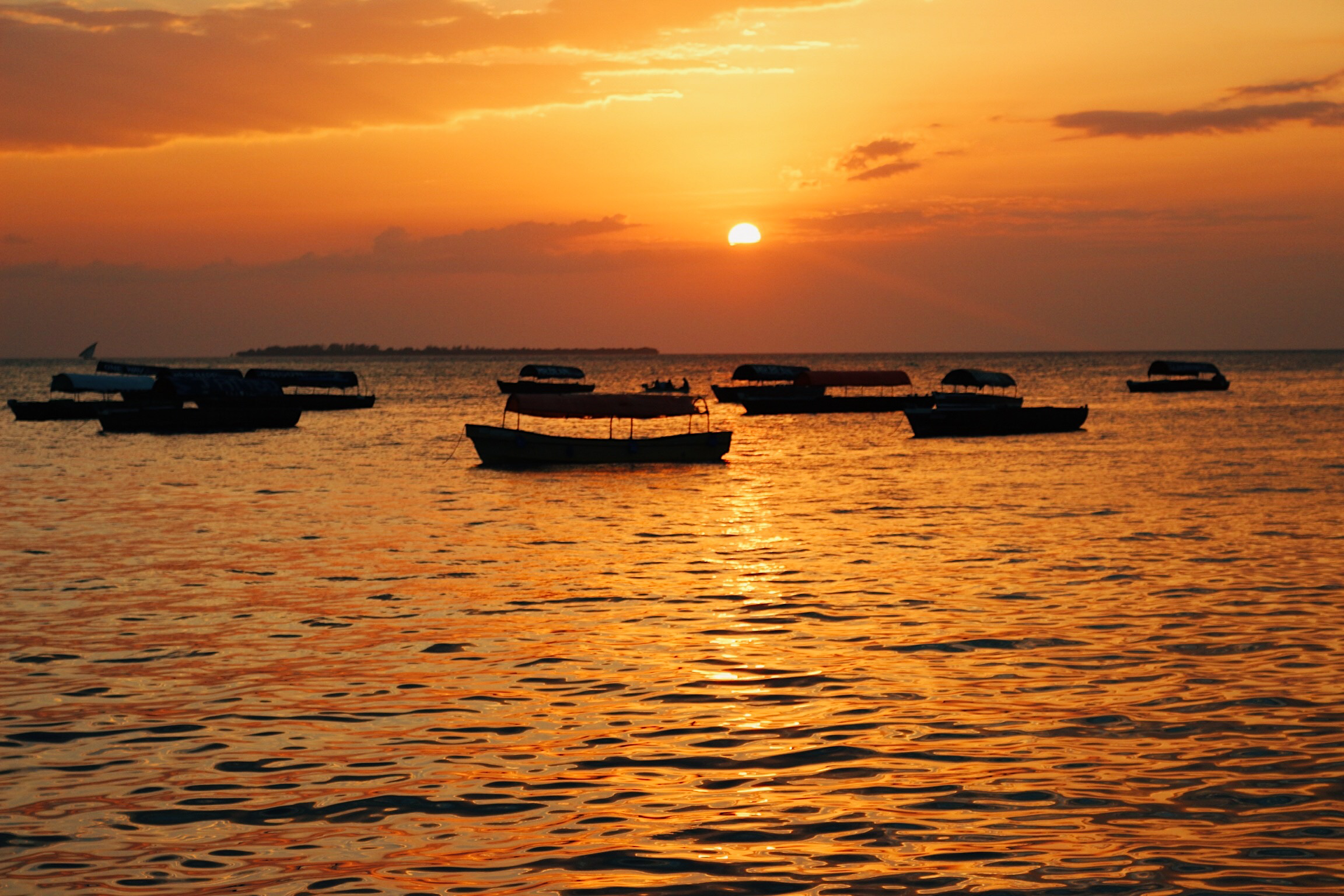
5-Day All-Inclusive Zanzibar Beach Honeymoon
Accommodation Melia This honeymoon itinerary offers a mix of adventure, relaxation, and intimacy, perfect for couples looking to celebrate their love in one of the...
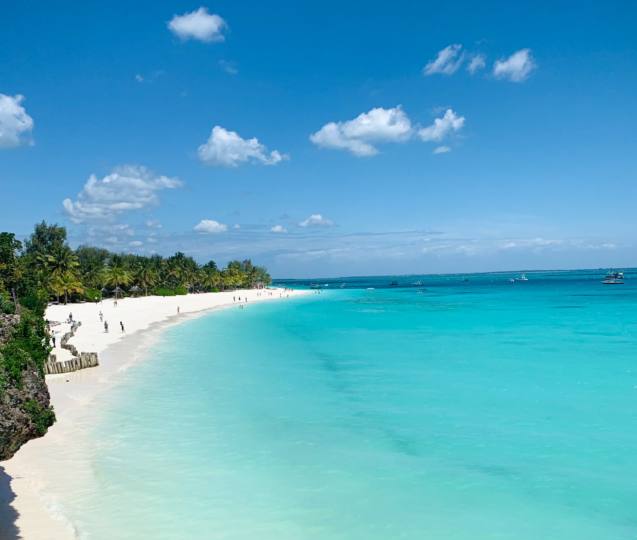
6-Day Zanzibar Adventure
This 6-day itinerary combines cultural exploration with plenty of time to relax on Zanzibar’s stunning beaches. Perfect for those looking to balance adventure and leisure.
8-Day Luxury Zanzibar Beach Holiday
This Package offers a blend of relaxation, adventure, and cultural exploration, all set in one of the most stunning island destinations in East Africa.

5-Day Mafia Island Tour
Polepole Bugalow for 2100USD single basis and 1625USD on double basis per person Full board Butiama Beach Lodge for 1210 single and 1035 per person...
5-Day Kilimanjaro Marangu Route
Marangu, or the ‘Coca Cola’ route, is the most famous route on Kilimanjaro. It is the only route where overnight accommodation is in huts. This
6-Day Kilimanjaro Marangu Route
The 'Coca Cola' route or Marangu is the most frequented route on Kilimanjaro. This route is famous for offering huts as accommodation which are easier.

8-Day Kilimanjaro Climb: Lemosho Route / Western Breach Route.
The Kilimanjaro Lemosho route is considered to be the most scenic of all routes. It is less traveled but arguably more picturesque, and at the.
6-Day Kilimanjaro Machame Route
Perhaps the most picturesque path to the peak, Machame offers many routes to and from the summit. On the way to Uhuru, step into mid-alpine.
7-Day Kilimanjaro Lemosho Route Itinerary
Considered the most beautiful and lush of all the Kilimanjaro routes, it is also the most remote. The Lemosho Gate is located on the western.

7-Day Kilimanjaro Machame Route
Machame has several paths to its highest point and back, perhaps the most scenic of which is to the summit, Uhuru. As you pass the.
9-Day Camping Safari Package in Tanzania
This 9-day camping safari is crafted for adventurers who want to immerse themselves in Tanzania’s stunning landscapes and rich wildlife while staying in well-organized campsites.

8-Day Kilimanjaro Climb: Lemosho Route / Western Breach Route.
The Kilimanjaro Lemosho route is considered to be the most scenic of all routes. It is less traveled but arguably more picturesque, and at the summit you'll have achieved one of the world's greatest climbing accomplishments.